Understanding what lies beneath the Earth’s surface is essential for energy exploration, mining, infrastructure development and groundwater management. Bentley Systems has announced that its subsidiary Seequent has acquired Eliis, a specialist in seismic interpretation software.
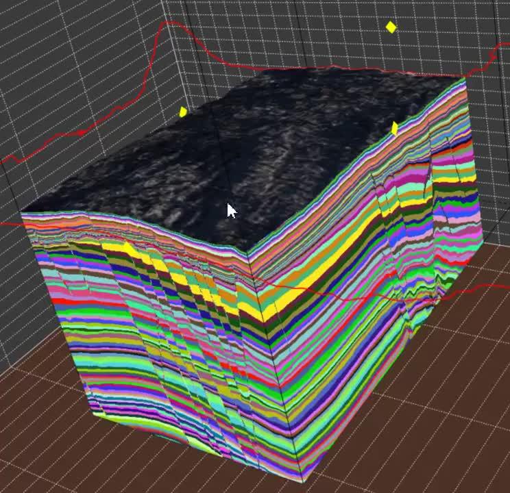
Founded in 2007 and headquartered in Montpellier, France, Eliis develops tools that help geoscientists interpret seismic imaging data and construct detailed models of underground geological structures. Its portfolio includes PaleoScan, a platform that uses seismic interpretation techniques and AI-assisted capabilities to support subsurface analysis.
Bringing Seismic Interpretation into a Broader Geoscience Workflow
Seismic data provides information about underground structures by analyzing how energy waves travel through geological layers. Interpreting these datasets can help identify geological formations, understand reservoir structures and reduce uncertainty in subsurface models.
Eliis’ technology complements Seequent’s existing geoscience portfolio, including its Leapfrog implicit modeling tools. The combination is intended to connect seismic interpretation with broader geological modeling and subsurface decision-making workflows.
Applications Beyond Oil and Gas
Although seismic interpretation has traditionally been associated with hydrocarbon exploration, its relevance is expanding. Mining companies can use improved geological models to investigate deeper mineral deposits, while infrastructure and environmental projects may benefit from better underground characterization.
The companies also point to potential applications in groundwater management, critical mineral recovery and carbon storage.
The acquisition brings more than 100 Eliis geoscientists, technical specialists and researchers into the Seequent organization.
For engineering and earth-science professionals, the strategic significance is the growing convergence of geophysics, geological modeling and data-driven interpretation. Better integration does not eliminate geological uncertainty, but it can help teams evaluate complex underground conditions with a more connected set of tools.