Digital twins are becoming more useful when they combine engineering models with information from real operating environments. Octave has released Alto 2026.1, an update to its geospatial visualization platform designed to bring multiple operational data sources into a consolidated environment.
The platform supports 2D, 3D and 4D visualization, analytics, data fusion, digital twins and real-time operational applications.
Combining Video and Geospatial Information
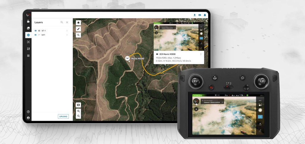
One of the main additions in Alto 2026.1 is the ability to display live drone and camera video directly on 2D maps and 3D terrain.
This approach aims to connect what an operator sees through a camera with the geographical and operational information associated with that location.
The update also introduces support for Gaussian splats, a technique that can transform photographs and scans into realistic 3D representations of real-world environments.
Applications in Infrastructure and Operations
The integration of video, location data and 3D terrain can be useful in infrastructure monitoring, aviation, transportation, public-sector operations and defense-related applications.
For example, an infrastructure team could view a live camera feed in its geographical context while examining the surrounding terrain and relevant asset information.
This can reduce the need to interpret separate screens and manually connect information from different systems.
The Digital Twin Challenge
A digital twin is only as useful as the accuracy, timeliness and context of the information it receives. Combining live video with geospatial models can improve situational awareness, but it also introduces requirements for data integration, cybersecurity, latency management and reliable visualization.
Alto 2026.1 illustrates a growing trend: digital twins are evolving from static 3D representations toward operational environments that combine real-time information with spatial context.